touchdown

Defense Wins Championships
Messages
4,689
Reaction score
3,491
My fav new channel on the Roku Channel is Fox Weather CH 164 - I love the 3D weather radar graphics and the really cool music in the Night Light programming.

It's also available locally OTA in DFW on KDFI CH 27.6

I also like Weather4us and Weather Tracker TV - DFW on Roku.
 

Doomsday

High Plains Drifter
Messages
21,399
Reaction score
3,794
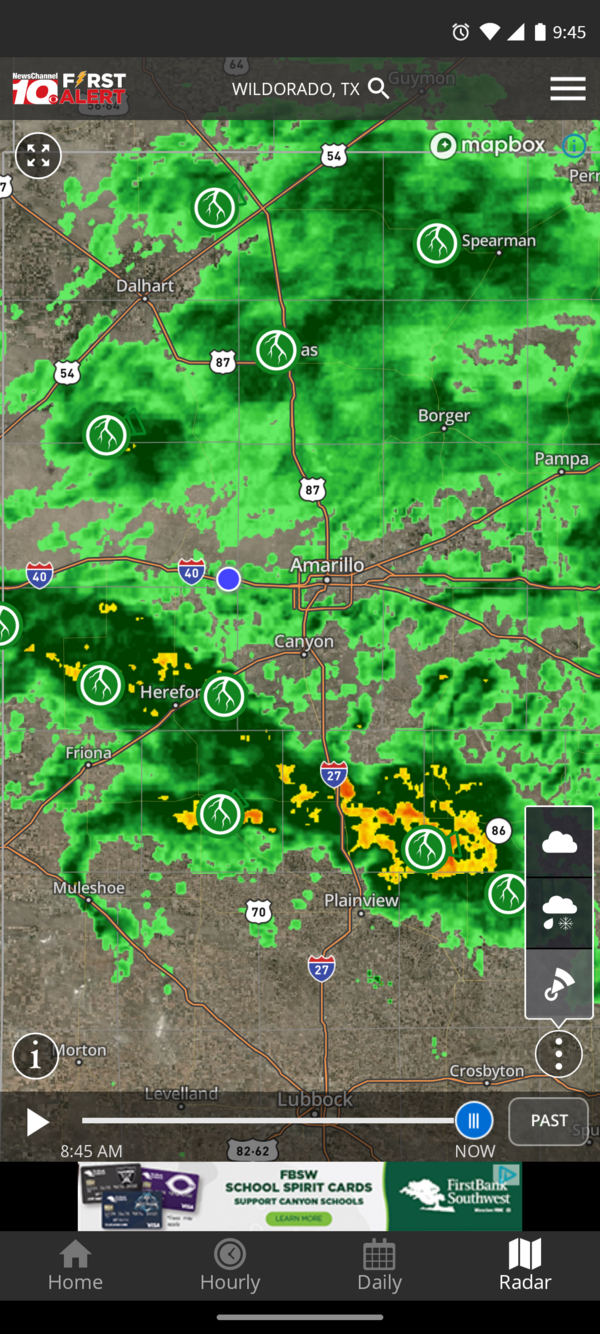
Steady moderate rain in entire area for the last 36 hrs. Here's live radar.
Screenshot_20220821-094539.png
 

touchdown

Defense Wins Championships
Messages
4,689
Reaction score
3,491
Hurricane Ian Landfall Coverage: Latest Track, Live Cameras, Q&A | Tracking the Tropics on WFLA Now


dbair1967

Administrator
Messages
54,846
Reaction score
6,107
This hurricane is Trump's fault!!!!!!!!!!!!!

No wait, this hurricane is DeSantis' fault!!!!!!!!!!!!!!!!!!!!!!!!!!!!!!

And if not for man made climate change this would have just been just a few passing rain showers.
 

touchdown

Defense Wins Championships
Messages
4,689
Reaction score
3,491
The NFL has bailed on the Browns game in Buffalo. The game has been moved to Detroit.
 

touchdown

Defense Wins Championships
Messages
4,689
Reaction score
3,491
The Buffalo metro area was hit particularly hard, with some areas south of the city receiving more than 5 feet of snow by early Saturday. According to the National Weather Service, the suburb of Orchard Park, home to the NFL’s Buffalo Bills, reported 77 inches (196 centimeters) by early Saturday. About 80 miles (129 kilometers) northeast of the city, the town of Natural Bridge, near the Fort Drum Army base, reported just under 6 feet.

The inundation forced the National Football League to move Sunday’s game between the Bills and Cleveland Browns to Detroit.

The National Weather Service predicted partial sunshine and a break from the snow on Saturday in New York, but not for long.

“Later on this evening and through early next week, we’re expecting another round of lake-effect snow for much of western New York,” National Weather Service meteorologist Zack Taylor told The Associated Press.


touchdown

Defense Wins Championships
Messages
4,689
Reaction score
3,491
With the warmer weather today, I took my car to QuikTrip to air up the tires. They were all 8 pounds low. Then I had to remember where to reset the tire monitor...
 

dbair1967

Administrator
Messages
54,846
Reaction score
6,107
Global warming is coming to Atlanta late this week and for weekend.

Lows of 12, 10 and 15, highs of 28, 33 and 39
 

touchdown

Defense Wins Championships
Messages
4,689
Reaction score
3,491
Short Range Forecast Discussion
NWS Weather Prediction Center College Park MD
234 PM EST Mon Dec 19 2022

Valid 00Z Tue Dec 20 2022 - 00Z Thu Dec 22 2022

...Arctic air and dangerous wind chills to remain entrenched across the
Northern Plains over the next several days...
...Heavy snows likely across the Northern Rockies, Washington Cascades and
Olympic Range...
...Arctic air to surge southward Wednesday and Thursday into the Central
to Southern Plains and Upper to Middle Mississippi Valley along with
dangerous wind chills...
..Heavy rains possible along the Central to Eastern Gulf Coast...

A very active weather pattern on tap for the upcoming holiday week across
large portions of the nation. The greatest impacts early in the week will
be across the northwestern quarter of the nation from the Northern Rockies
into the Northern Plains. Arctic air will remain entrenched over the
next two days across the Northern Plains where high temperatures will
remain below zero across much of Montana, North Dakota, South Dakota and
most of Minnesota and morning low temperatures will be in the -10s to -30
degree range. In addition to the brutally cold temperatures, dangerous
wind chill values of 35 to 55 degrees below zero are possible into the end
of the week across these areas. Wind chill warnings and advisories are
currently in effect across these areas for most of the week. In addition
to the cold temperatures and dangerous wind chills, heavy snows are also
possible along the arctic front as it sinks southward through the Northern
Rockies. Heavy snows also likely from the Washington Cascades into the
Olympic Range.

This arctic air will begin to surge to the southeast on Wednesday and
Thursday across the Central and Southern Plains and into the Middle to
Upper Mississippi Valley. Very large temperature changes likely in the
wake of this arctic front with temperatures 35 to 40 degrees colder
Thursday than on Wednesday across the Central Plains. Similar to areas
farther to the north, dangerous wind chill values will spread southward
with this arctic air, with wind chill watches up across all of the Central
Plains into portions of the Southern Plains.
 
Top Bottom